
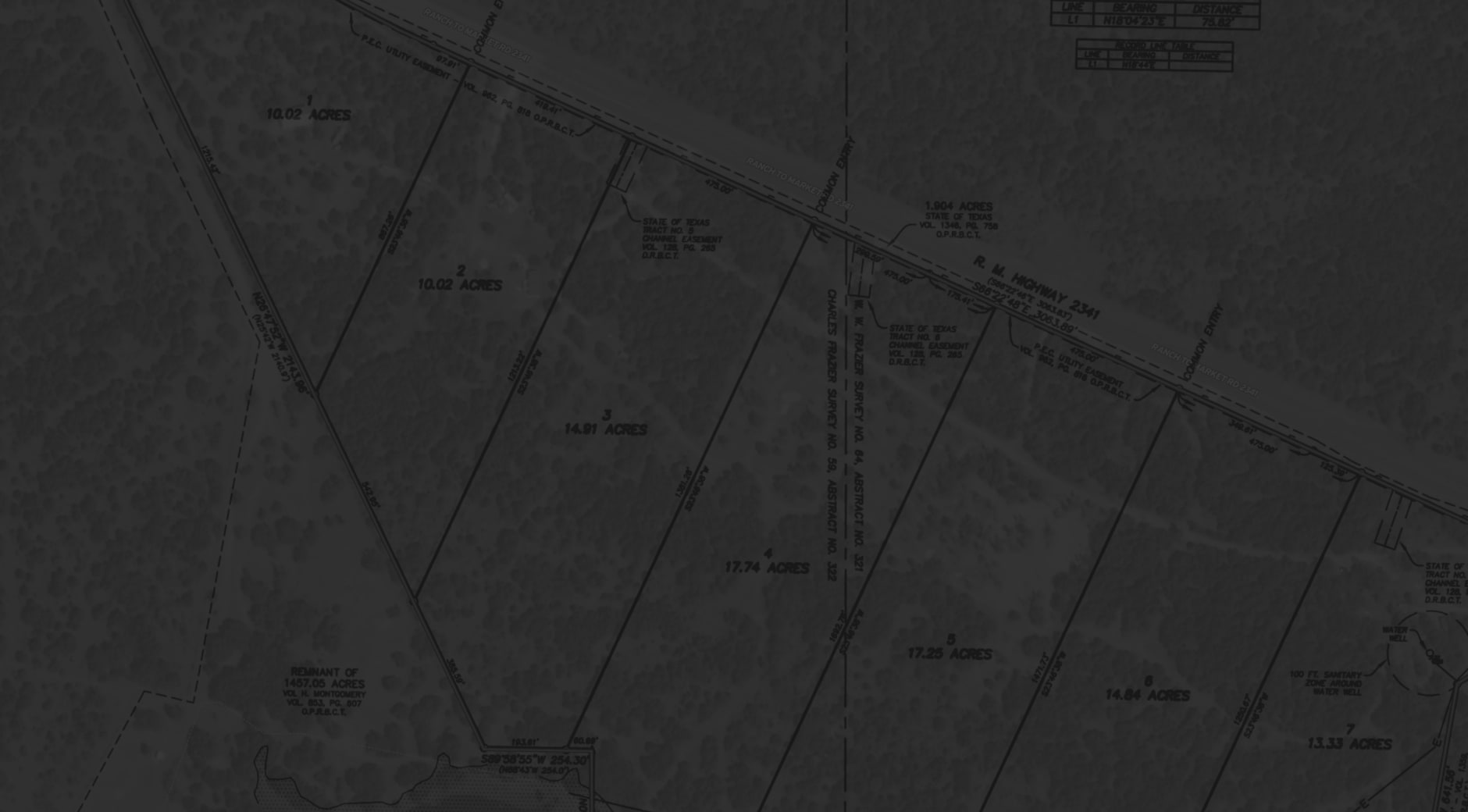


Enhanced Georeference
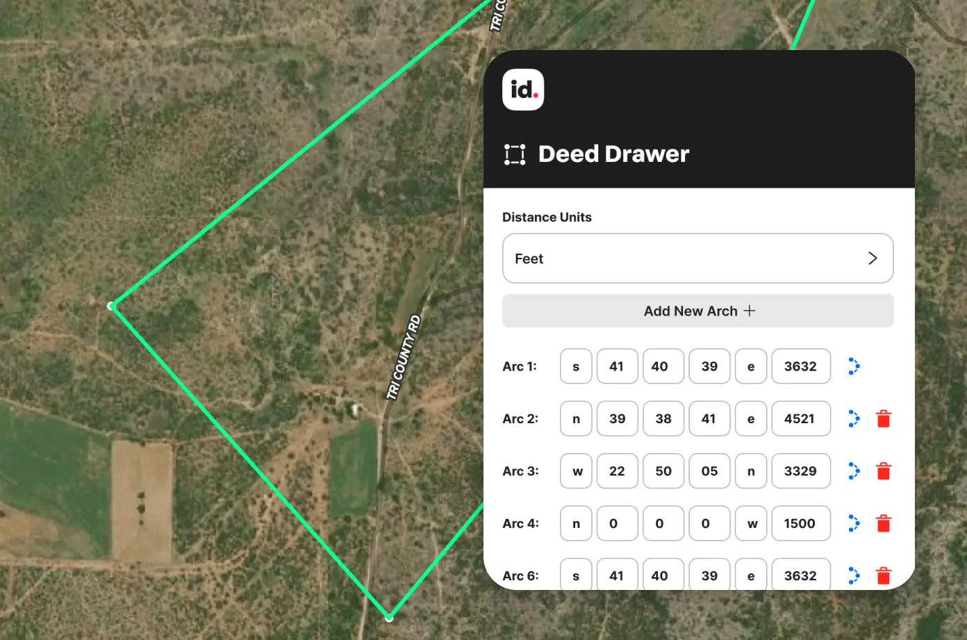
Plot Deeds & Outline Lots With Precision
Easily overlay survey images, site plans, and visual guides on top of any map for accurate orientation and alignment.


No items found.
No items found.

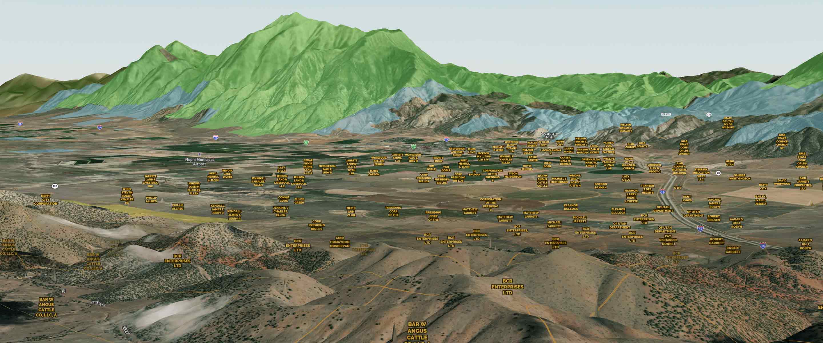
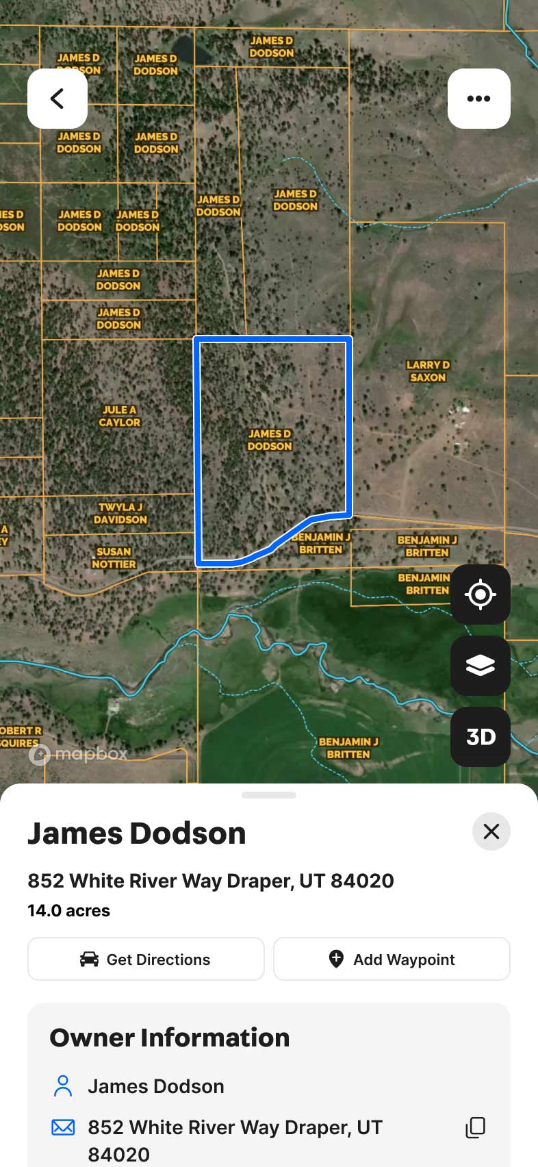
Explore Private Parcel Data & Property Boundaries
Download the Land id™ app & try the Discover plan for free


No items found.
Explore Private Parcel Data & Property Boundaries
Download the Land id™ app & try the Discover plan for free
No items found.
No items found.
Explore Private Parcel Data & Property Boundaries
Download the Land id™ app & try the Discover plan for free
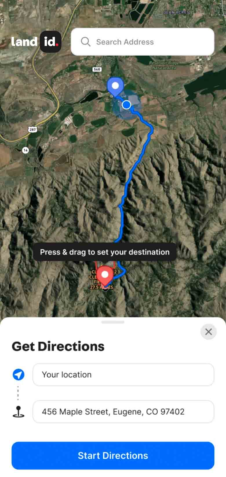
Georeference Embed Map
See it in Action
Land id™ allows you to add multiple georeference images and integrate various GIS overlays and features, providing you with a complete land mapping solution.


Explore Private Parcel Data & Property Boundaries
Download the Land id™ app & try the Discover plan for free

Demo request received.
One of our experts will reach out shortly to schedule your demo.
Oops! Something went wrong while submitting the form.
Explore Private Parcel Data & Property Boundaries
Download the Land id™ app & try the Discover plan for free
